
Eine Stadt mit Stundenplan
Ein Universitätscampus ist eine kleine Stadt, deren Bevölkerung sich jeden Herbst austauscht und deren Navigationsspitzen in geplanten Schüben kommen: Tage der offenen Tür, Einschreibungswoche, der erste Montag des Semesters, Prüfungszeit. Allgemeine Kartenapps deckennen die Außenhöfe ab und scheitern genau dort, wo der Bedarf beginnt, an der Gebäudetür, denn Raum E2.14 existiert auf keiner Stadtkarte. Campus-Navigation ist das Innen-Außen-Übergabeproblem in institutionellem Maßstab.
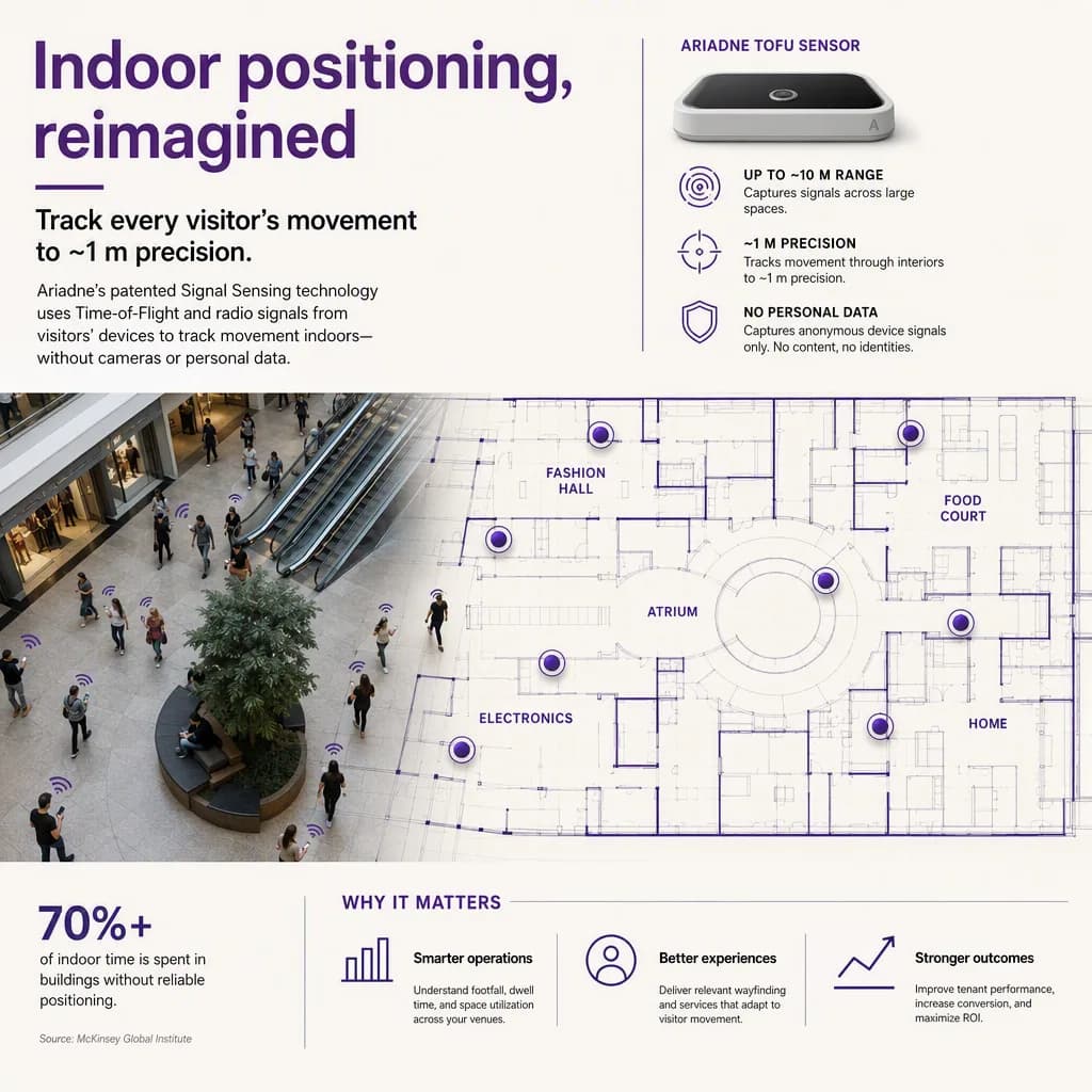
Was sollte Campus-Navigation abdecken?
Vier Schichten: Außenrouting über den Campus (das können allgemeine Karten), Gebäudeeingänge passend zum Ziel des Besuchers (das können sie nicht; der richtige Eingang für einen Hörsaal ist selten der Haupteingang), Innenrouting zu Räumen, Labors und Büros, und Event-Overlays, wo dasselbe Gebäude im Modus "Tag der offenen Tür" andere Ziele bedeutet als im Prüfungsmodus. Die bindende Randbedingung ist das Raumverzeichnis: Navigation ist nur so gut wie die Zuordnung zwischen "Technische Thermodynamik, Di 9:00" und einer Tür auf einem Grundriss.
Der Kalender ist das Lastenheft
Campus-Navigation verdient sich an konkreten Terminen. Tage der offenen Tür: Tausende Erstbesucher mit Familien, die nach Zeitplan zwischen Vorträgen wechseln, wobei der Konversionstrichter der Universität (buchstäblich: Einschreibung) mit jeder Familie leidet, die die Chemie-Demo nicht findet. Erste Woche: der gesamte Jahrgang navigiert gleichzeitig, und Zuspätkommen ist die Norm, die die Institution früh brechen will. Prüfungswochen: unbekannte Räume über den Campus verteilt, hoher Stress, null Fehlertoleranz. Ein System, das am durchschnittlichen Dienstag verkauft wird, verkauft sich zu billig; dimensionieren Sie es an diesen Spitzen, mit Event-Modus-Overlays als Testfall.
Auslieferung: Web zuerst, Kioske an den Nähten
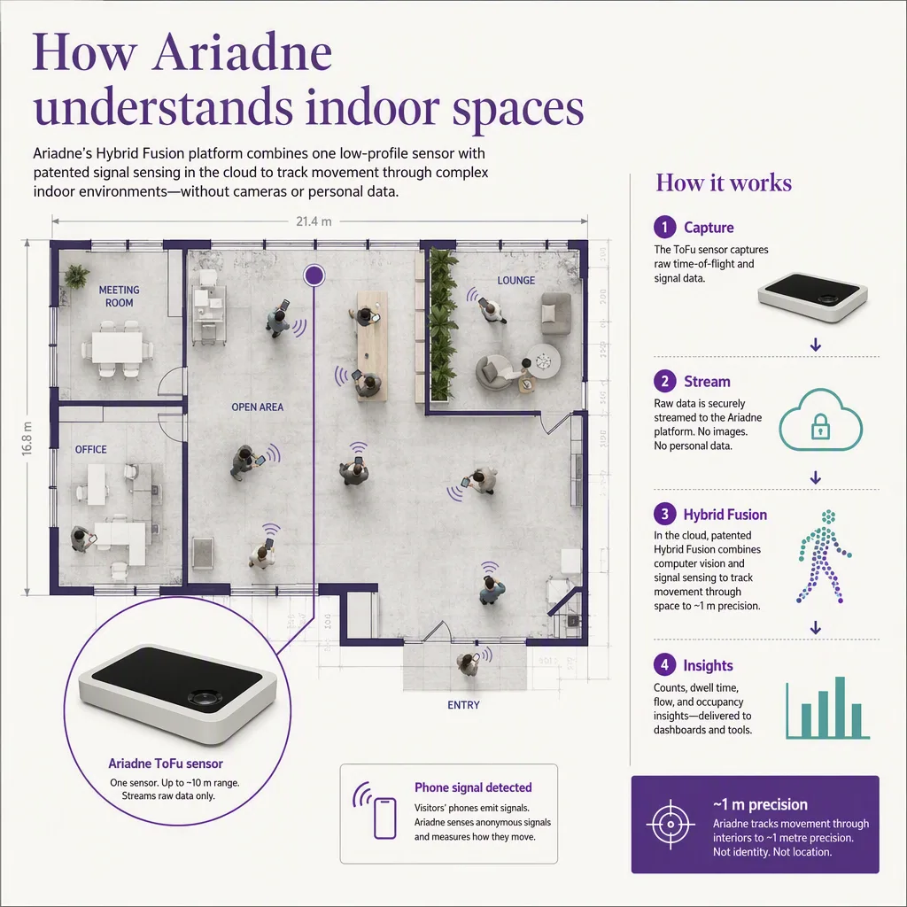
Studierende leben auf ihren Telefonen, aber Einmalbesucher (Bewerber, Familien, Konferenzgäste) installieren nichts: Webbasierte Routen, verlinkt aus Eventseiten und Bestätigungsmails, tragen die Spitzenlast. Kioske gehören an die Nähte (Haltestellen, Parkbauten, Hofkreuzungen), platziert dort, wo der gemessene Fluss wirklich vorbeikommt, gemäß Kiosk-Platzierung nach Flussdaten, und der Trade-off Kiosk gegen statische Karte neigt hier zum Kiosk, gerade weil Campus-Ziele sich pro Semester ändern.
Barrierefreiheit ist hier kein Randfall
Universitäten tragen rechtliche und moralische Barrierefreiheitspflichten, und über ein Jahrhundert gewachsene Areale sind voll von Stufen-Abkürzungen, die ausschließen. Stufenloses Routing als eigener Modus, mit barrierefreien Wegedaten als Teil der Karte, ist der Unterschied zwischen Compliance auf Papier und einer Studentin, die im Hörsaal ankommt.
Wo Ariadne einzuordnen ist
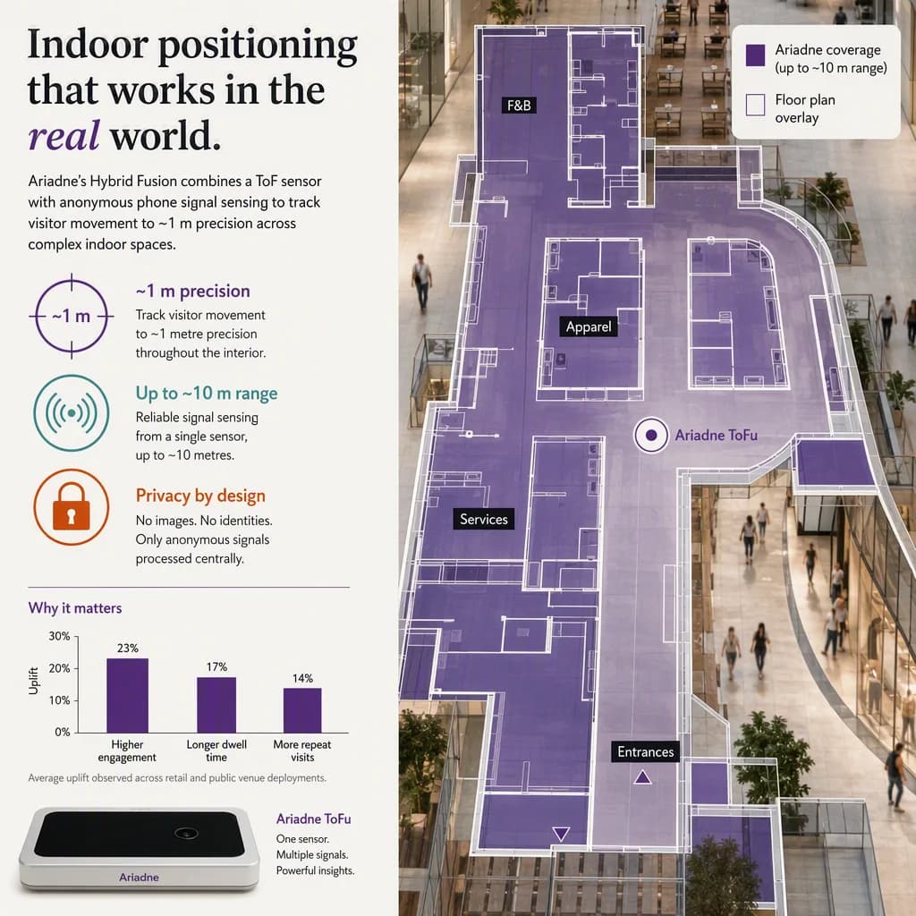
Ariadnes Plattform verwandelt Campus-Grundrisse in Live-Führung über App, Web und Kioske, auf datenschutzfreundlicher Positionierung, mit der Messschicht darunter, die zeigt, wo Journeys hängen, welche Gebäude den Besucherandrang aufnehmen und ob die neue Beschilderung tatsächlich etwas geändert hat. Das vollständige Plattformbild steht in dem Indoor-Navigation-Pillar, und Campus erscheinen dort neben Flughäfen und Krankenhäusern.
---


